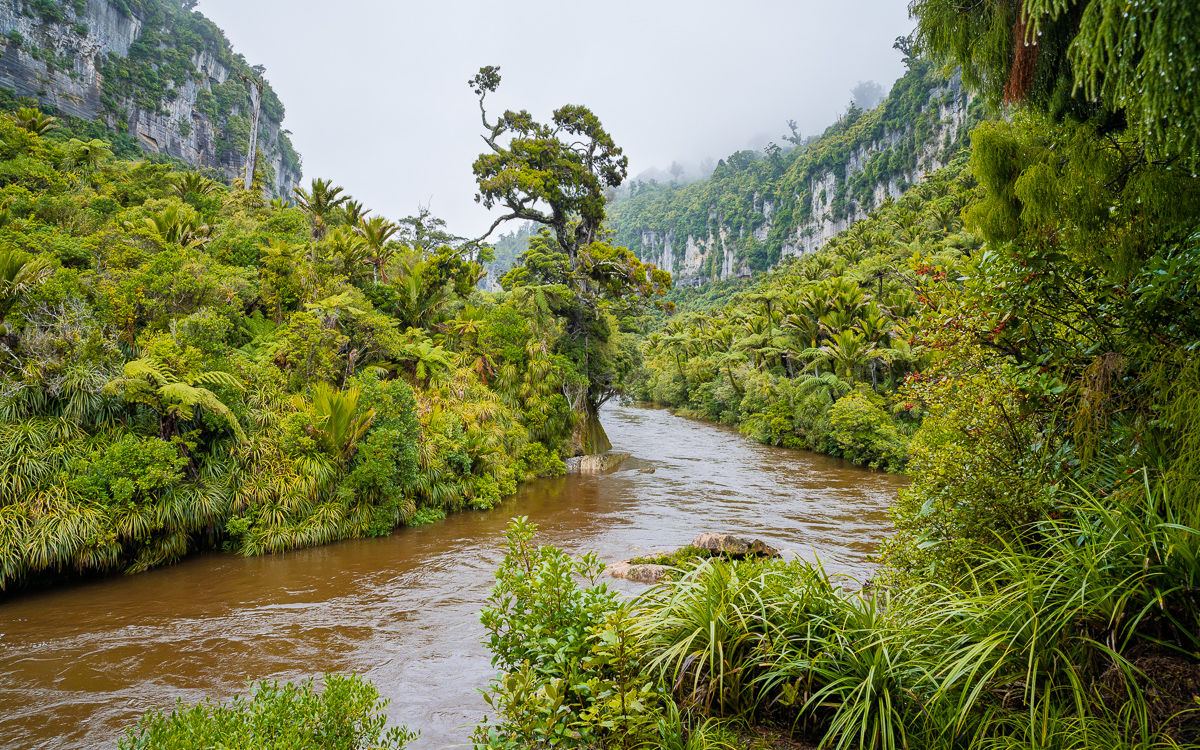
We’re at the beginning of week 4, our last week here in NZ. I’m sitting at the dinner table of our *fantastic* airbnb here on the north island in a little beach town called Kūaotunu on the Pacific Ocean. The back of the property has a deck which has to be 50 feet wide covering the full width of the house and then some. The living space has accordion glass doors that open up most of the back wall of the house, letting in the ocean air. The trees are filled with birds, and the hill that we’re on faces another larger tree-covered mountain. Off to the left is the beach where surfers enjoy the waves in this quiet little town. It’s an amazing spot, once again reaffirming my *love* for Airbnb.
Anyhoo, I’ve been quite negligent in creating content for our blog these weeks so I wanted to rectify that on this slow Easter Monday.
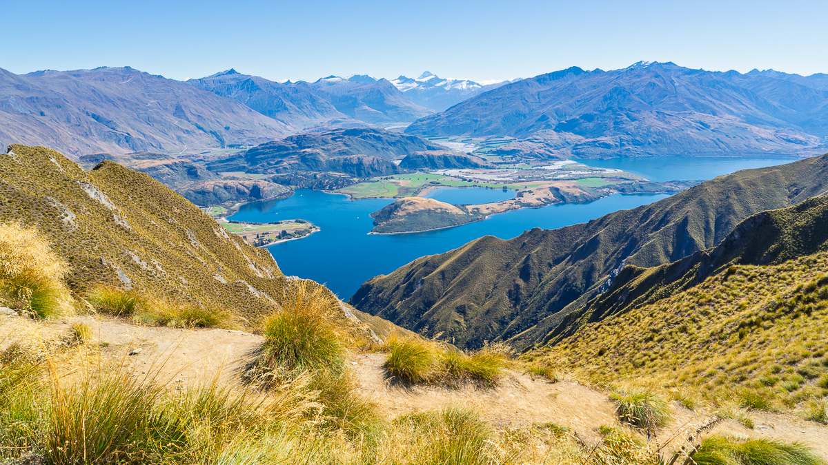
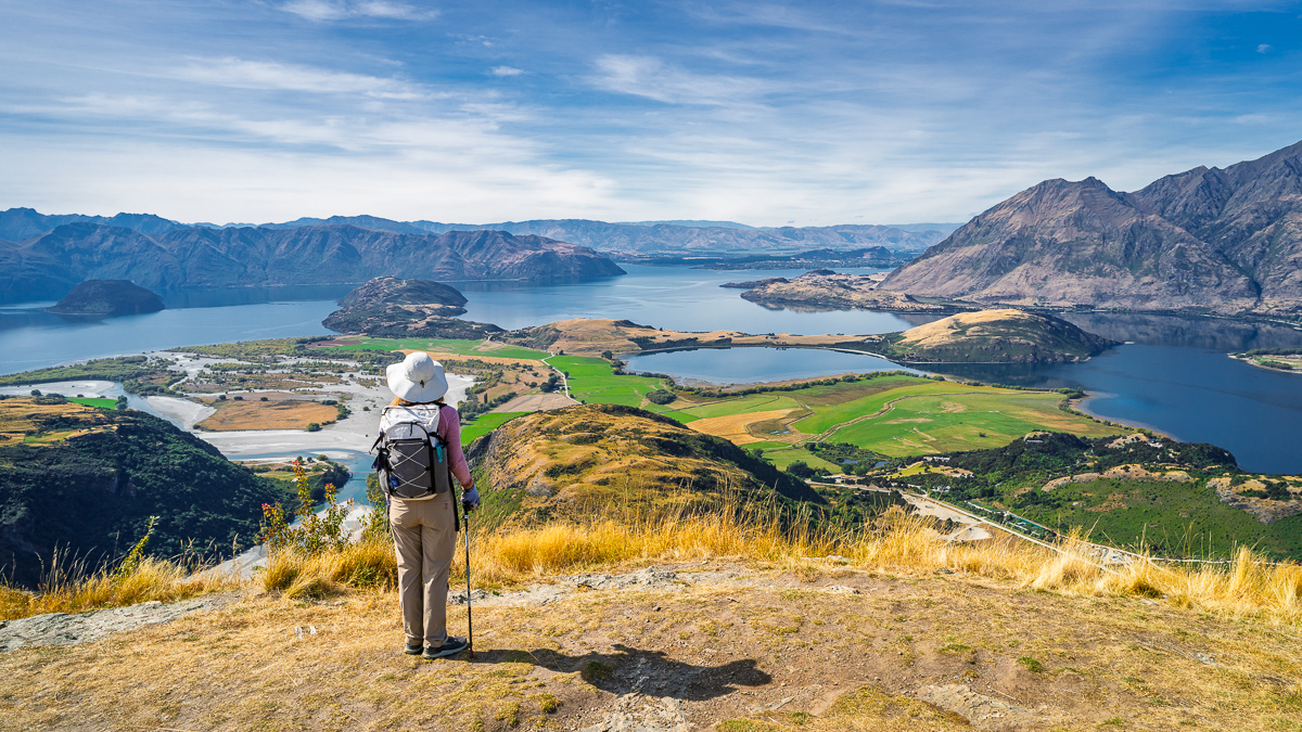
Lake Hāwea / Wānaka – Otago NZ
After leaving Te Anau we headed back a little farther north, passing through Queenstown and heading toward Wānaka which is south of the Mount Cook area that we visited during our first week. We stayed in a smaller town called Hāwea which is just a few minutes east of Wānaka.
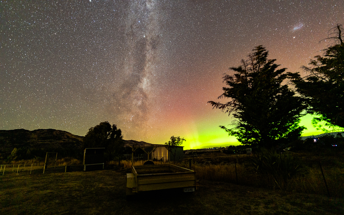
We stayed in an Airbnb Guest house in a quiet neighborhood near the grade school. It was a great spot to relax but was close enough to Wānaka and some of the epic hikes in the area. While we were there, there were some of the strongest instances of southern lights that we saw during our time here. You could easily see the greens and purples on the horizon with the naked eye.
Two Epic Hikes – Roys Peak Track & Diamond Lake / Rocky Mountain Track
Our two big activities here were to hike the famous Roys Peak track and the even more epic Diamond Lake / Rocky Mountain Track which is just a few minutes further north.
Disclosure, we didn’t actually go the last quarter of a mile or so up to summit Roys Peak. Once we got to the crest and could see the lakes, we had lunch and headed back down. The trail is brutal. No shade, constant incline. It’s a little over ten miles out and back with 4200 feet of elevation gain. It’s a hard trail and the views on the way up (and down) of Wānaka down below are nice but they get monotonous over such a long and grueling hike. The views once you reach the crest and can finally see the lakes and mountains on the horizon are absolutely breathtaking, and arguably worth the rigorous hike.
Our plan was to take it a little easier on our next hike and just go out to Diamond Lake Lookout track which is about a two mile trail with a paltry 500 feet of elevation gain. But once we got to the lookout we were feeling pretty good and decided to extend our hike and do the full loop which adds in an ascent of “Rocky Mountain.” It included climbing another 1100 feet, and three more miles of hiking, but the views along the way and at the peak were more than worth it. Honestly, if someone asked me which one i would suggest if they were only going to have one day to hike in the area, I’d go for the Diamond Lake and Rocky Mountain Track over Roys Peak. Far fewer people, more variety in views along the way and much less of a climb.
West Coast
After leaving Hāwea we crossed over the mountains and went to the West Coast region. This area is well known for its breathtaking green scenery, epic glacier views and the rugged west coastline. Unfortunately, it’s also famous for being wet and rainy, and boy did it deliver.
We spent five days on the West Coast, split between Franz Josef and Punakaiki, and it rained every single one of them. Unfortunately we never really got good views of the Franz Josef Glacier. But in Punakaiki we did get some nice views of the famous Pancake Rocks and went on a very wet hike through the rain forest on the Pororari River Track. The trail is nice and mostly tree-covered ,and the towering cliffs that the river is carved into are pretty amazing. It was very different scenery than the dry and arid hikes that we did in the Hāwea/Wānaka area days before.
Picton – Wellington Ferry
We wrapped up our time on the south island by driving over to Picton where we spent our last night on the South Island. Picton is a small coastal town which is known for its ferry port. We took the Bluebridge Ferry from Picton to Wellington to start our north island adventure. The drive from Punakaiki to Picton is about four and a half hours, and we didn’t plan to stop in Wellington, but to drive north to Tongariro National Park, so we wanted the earliest ferry. The first ferry of the day is the 7:45. For that voyage, check-in closes at 6:45 so it’s bright and early, or dark and early as was the case.
Lucky for us, our ferry was pretty much on time. The ride is about three and a half hours. Once in Wellington we had another four and a half hours to drive. Driving in Wellington was quite different than everywhere we went on the South Island. There are multi-lane freeways and much more traffic. Driving on the left is always a bit foreign to me, but driving on two-lane roads is different from being in a city with freeway onramps.
Tongariro National Park – Manawatu-Wanganui Region
I’ll admit, I didn’t do a lot of research on what exactly to do in Tongariro National Park. We rented a cabin for three days in the national park. The park has a number of volcanos and a lot of hiking trails. So, don’t hate me for saying it but… I was not aware of the Tongariro Alpine Crossing aside from a Facebook friend asking if we intended to do it. The proper way to do the trail is as a point to point hike. It’s a little over 12 miles from start to finish. Since we hadn’t made any real concrete plans to do it, we hadn’t figured out the shuttle system. On our first morning there, I checked the weather and it looked like that day was going to be ideal, but the following day, not so much. So we made the last minute decision to take an alternate route and do the trail as an out and back so that we wouldn’t need the shuttle. We started at the Mangatepopo Carpark and hiked up to the rim of Red Crater and back. The route we took was just shy of 12 miles with about 2,700 feet of elevation gain.
The weather we got that day was absolutely amazing. We had cloudless volcano views for most of the trail and the view from the rim of Red Crater is just about one of the most amazing things I’ve ever seen in my life. Photos just don’t do it justice. At the 6,100 foot peak you’re surrounded by dry lake beds, steaming emerald ponds, the absolute wrecked crater which looks like something from an alien planet. Oh, and a huge alpine turquoise lake! I was at a loss for words. I was at a loss for words. All I could say was fuuuuuuk!
The second day we spent in Tongariro National Park we did a much shorter trail. The Taranaki Falls walk which basically started and ended at our front door. It’s just short of four miles and has a surprising amount of scenic variety since you hike down into a tree-lined valley following a river out to the waterfall. It’s about 500 feet of total elevation gain which made for a nice relaxing trek after hiking up the rim of Red Crater.
Kūaotunu – Waikato Region
After leaving Tongariro National Park we came up to where we are now, the beach town of Kūaotunu. This was one of our longer drives in New Zealand. It’s about five and a half hours between here and Tongariro National Park. There was a wide variety of scenery heading up here. Flat farm land, many kilometers of wine vineyards, rolling hills which surely inspired the look of The Hobbit. The last hour and a half or so was the slowest. That’s where you’re driving on twisting coastal roads with tons of hills and blind corners. That last bit was mostly driven less than 50km/hr so it felt like it took forever to get here. We don’t really have a lot of adventures planned here. We’ll probably go walk on the beach. Maybe check out a very low trafficked beach not far from here that a local recommended yesterday. And also check out a fish and chips place that was also suggested. At this point I’m just relaxing and preparing my mind to be on a ship for three weeks starting next Sunday. If things go according to plan we’ll be setting sail from Auckland heading towards Los Angeles.